

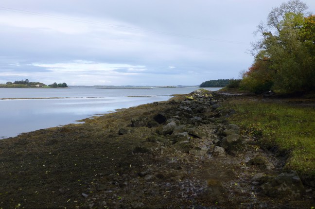
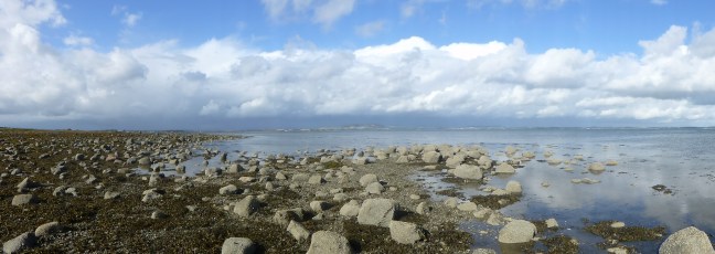
Strangford Lough is one of the three sites chosen on the Irish Sea as a case study in the ‘Cultural Value of Coastlines’ project. It is the largest marine nature reserve in the UK and Ireland, and is a designated AONB (Area of Outstanding Natural Beauty). The lough extends from a narrow exit to the Irish Sea at its southernmost point, to the town of Newtownards at its northern tip. It is surrounded to the east and north by the Ards peninsula, with the Lecale peninsula to the south. A large expanse of the lough consists of intertidal zone, accounting for about one third of its total area, approximately 50km2. The coastline features extensive mudflats, with some sandflats, saltmarsh, and rocky shores, and perhaps its most distinctive natural feature is the drowned drumlins which form the many islands in the lough. The lough is also important for wildlife (Brown 1990) ,especially wildfowl and waders, and is home to a Wildfowl and Wetlands Trust site, Castle Espie, on its western shore . Key settlements around the lough are the small ports of Killyleagh, Strangford and Portaferry in the south, and the towns of Newtownards and Comber in the north.
Strangford bears in its name its reputed importance for the Vikings, meaning strong fjord. The earlier Gaelic name for Strangford Lough is Loch Cuan, meaning loch of the havens, indicating its importance for mariners seeking safety from rough seas. The entrance to the lough, however, is itself treacherous, and archaeological records of shipwrecks show a concentration of wreck sites in the Narrows. There are a large number of harbours, quays, and landing places around the shores of Strangford Lough, and a detailed archaeological survey of the lough’s maritime cultural landscape conducted in the 1990s revealed intensive maritime activity over thousands of years, including a once thriving kelp industry, a network of quays and slipways all around the lough, and older evidence of stone and wooden fish traps (McErlean 2002). Perhaps most impressively, evidence was uncovered of a seventh century tidal mill at the monastery of Nendrum. Tidal power continues to be important in the lough, with an experimental submerged tidal generator located in the Narrows.
There are many ways in which the communities around the lough have been shaped by the sea, and continue to depend upon it. While fishing and kelp farming were key to survival in the past, today maritime cultural heritage is recognised as an important resource, from the bird-watching activities in Castle Espie and the Exploris Aquarium in Portaferry, to the many abbeys, towers, and castles which testify to the importance of the sea as a highway and a form of protection for earlier communities. The sheltered shores of Strangford Lough also provide many opportunities for maritime recreation activities, including canoeing, diving, sailing, and fishing. The variety and beauty of the shores around the lough have also attracted significant interest from artists, writers and photographers, including perhaps one of the most famous novels written in Northern Ireland, Sam Hanna Bell’s December Bride (1951).
Notes:
Sam Hanna Bell, December Bride. London: Dennis Dobson, 1951.
Robert Brown, Strangford Lough: The Wildlife of an Irish Sea Lough. Belfast: Institute of Irish Studies, 1990.
Thomas McErlean, Rosemary McConkey, and Wes Forsythe, Strangford Lough: An Archaeological Survey of the Maritime Cultural Landscape. Belfast: Blackstaff Press/ Environment and Heritage Service, 2002.
